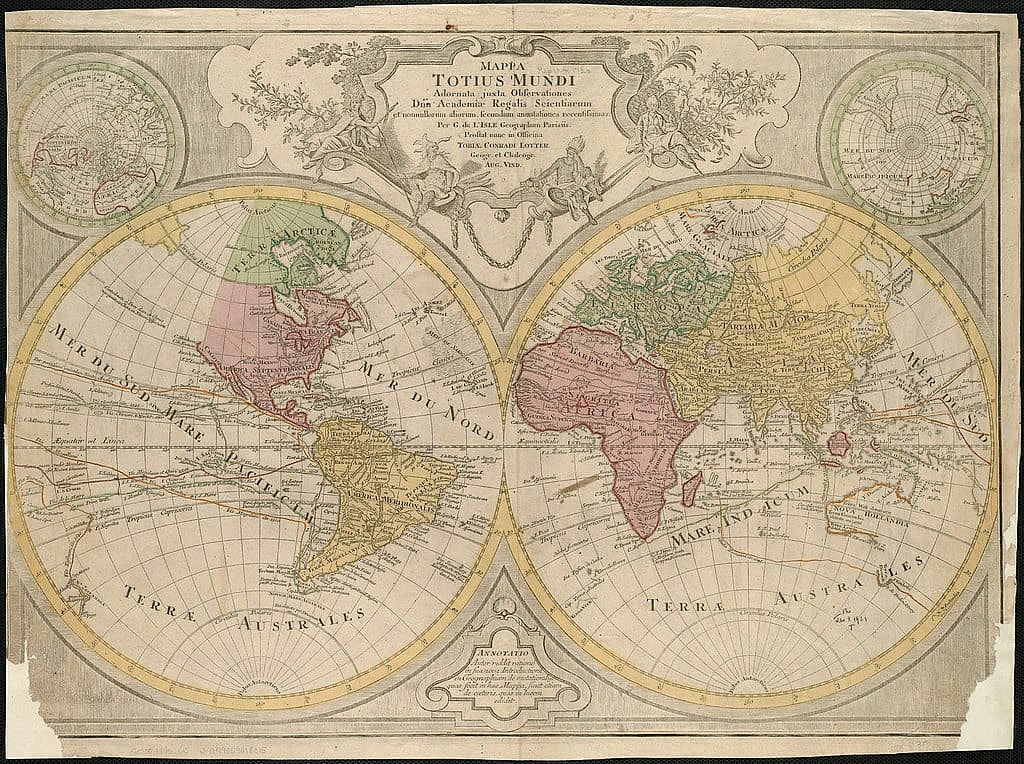
Maps have long been a vital resource for interpreting the world, delineating boundaries, and directing scientific inquiry. However, old world maps have historically frequently represented not only geographical information but also myths, cultural beliefs, and theoretical notions about the world.
Examining these old world maps offers insight into the intellectual and cultural milieu of their periods as well as the evolution of cartography expertise. They draw attention to the ways in which mythology, religion, and developing scientific ideas were entwined with geographic awareness. We can better appreciate the intricate process of discovery and the noteworthy discoveries that have influenced our present-day understanding of geography by looking at these old world maps.
Read More: Why All The World Maps Are Wrong?
13. Strabo’s Map
The year Strabo’s map was created is unknown, but it’s believed to have been made around 20 BCE. The map is included in the Geographica, which is an extensive encyclopedia of the known geographical knowledge of Strabo’s time. Not only are there extensive descriptions of the geographical area, but also details of historical information.
Read More: Forgotten Battles That Changed the Course of History
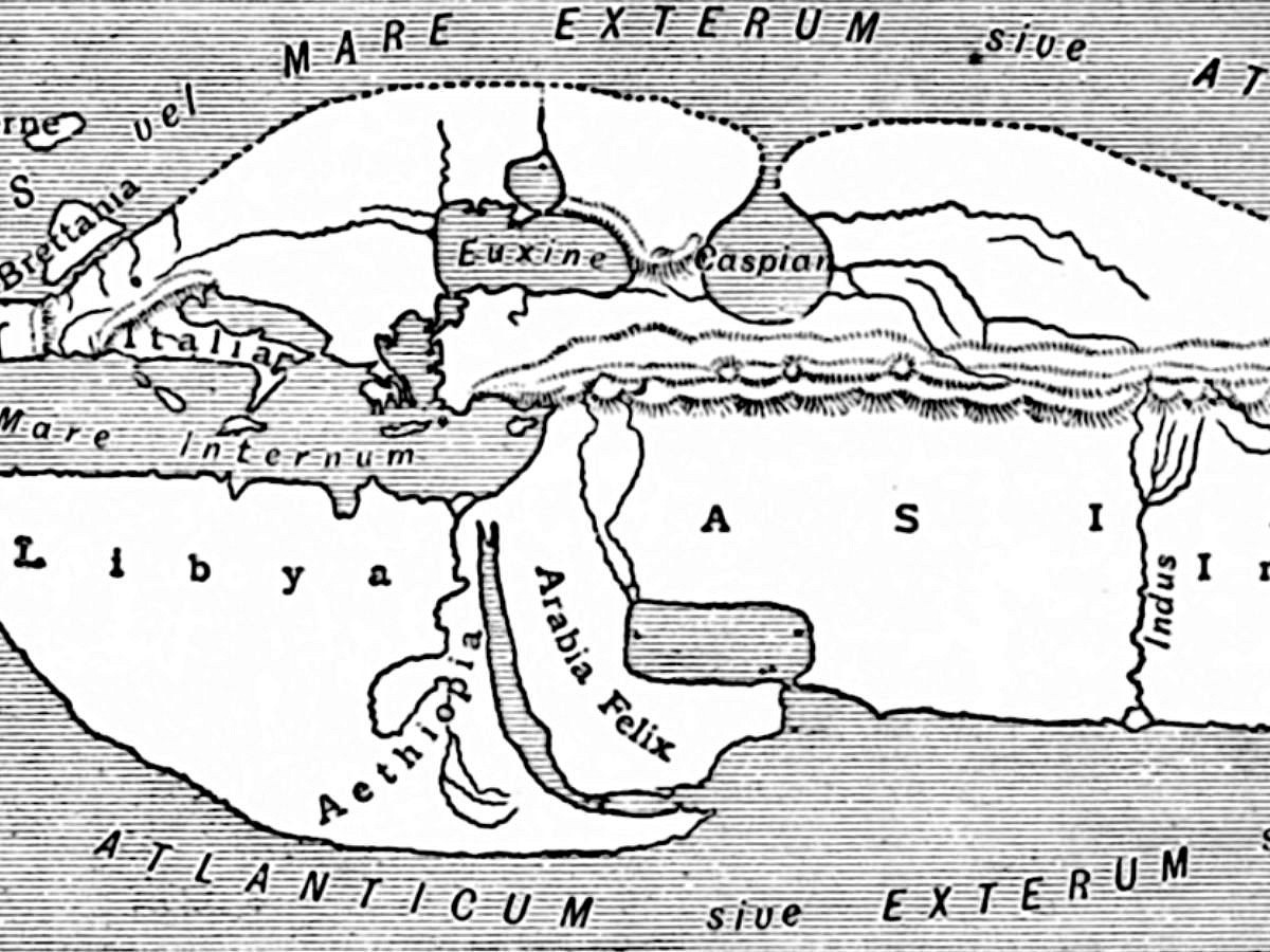
12. Posidonius’ Map
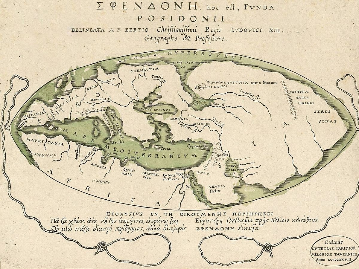
Posidonius didn’t actually create any known maps. Instead, his work is known through the works of later Greek scientists and the cartographer Petrus Bertius, who drew his map around 1628. Posidonius calculated the circumference of the Earth using the work Eratosethenes had already done. However, while they were accurate in their calculations, mistranslation caused later geographers to miscalculate the circumference.
Related: Forgotten Battles That Changed the Course of History
11. Eratosethenes’ Map
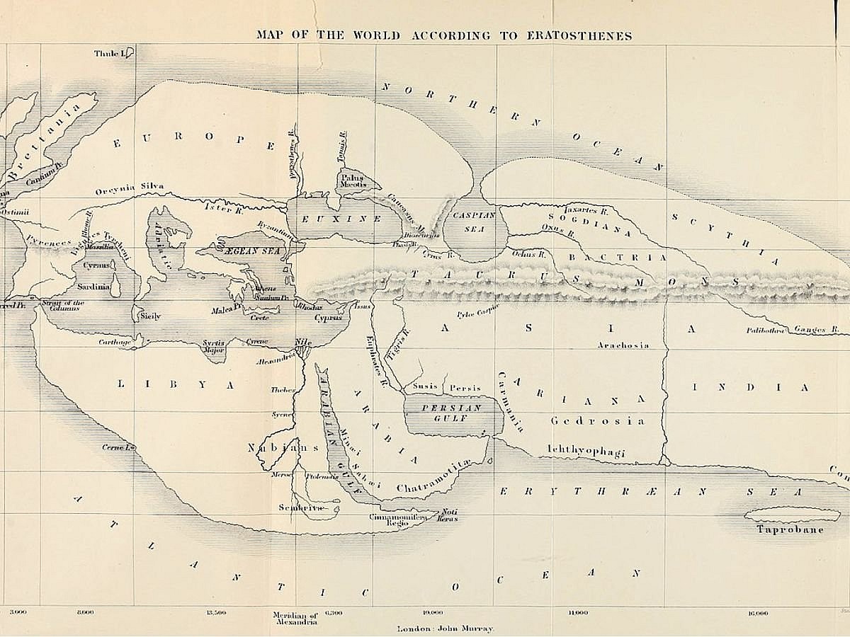
The map that inspired Posidonius’ work is the Eratosethenes map, which was created around 194 BCE. Eratosthenes is known as the Father of geography for expanding on previous maps and using a more scientific approach to mapping the world. With extensive mathematical and scientific knowledge to determine
Read Next: Best Preserved Shipwrecks Around the World
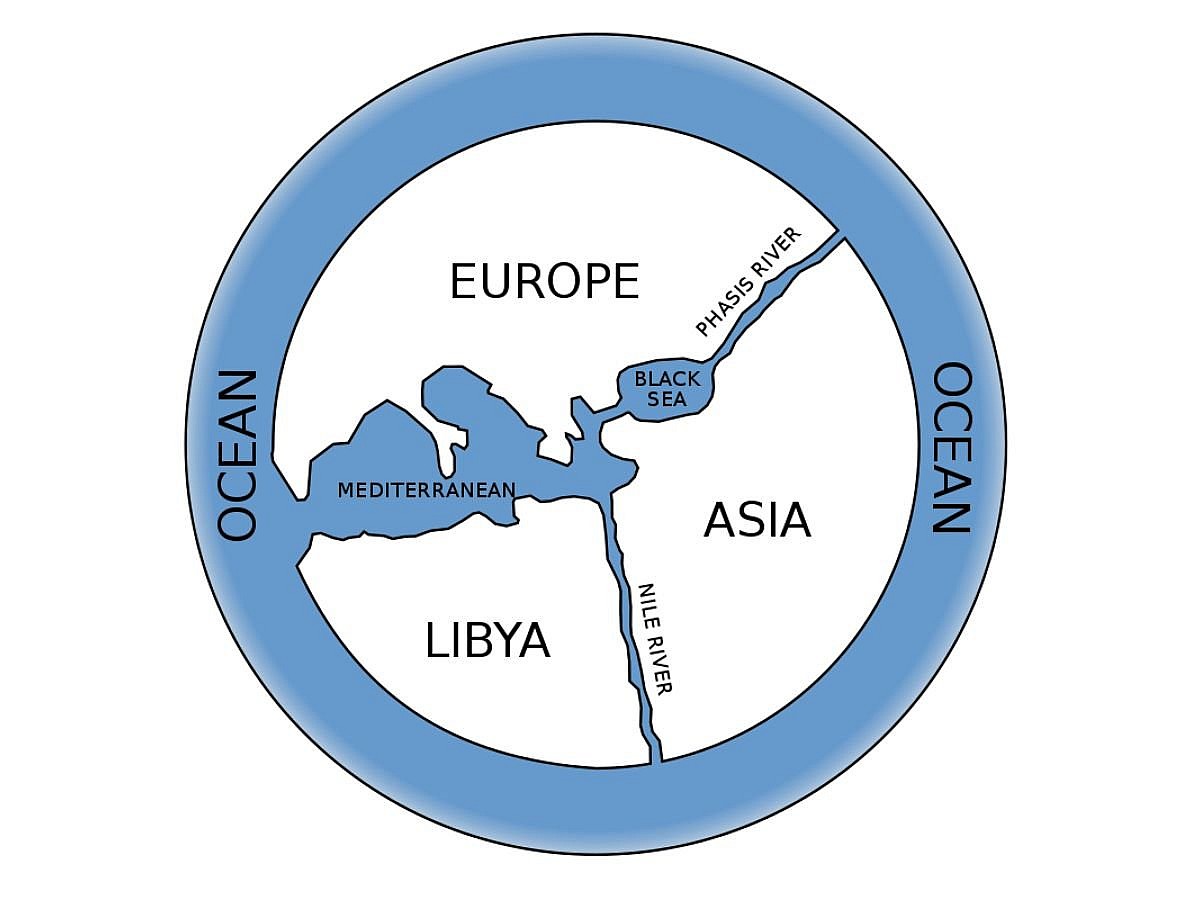
10. Hecataceus’ Map
The Hecataceus’ map is one of the best old world maps that offers a glimpse into the past. The map was another from the Ancient Greek city of Miletus, and actually studied the Anaximander map and built his world by expanding and improving upon it. The map was created around 550 to 476 BCE.
Also Read: Forgotten Royal Scandals That Shocked the World
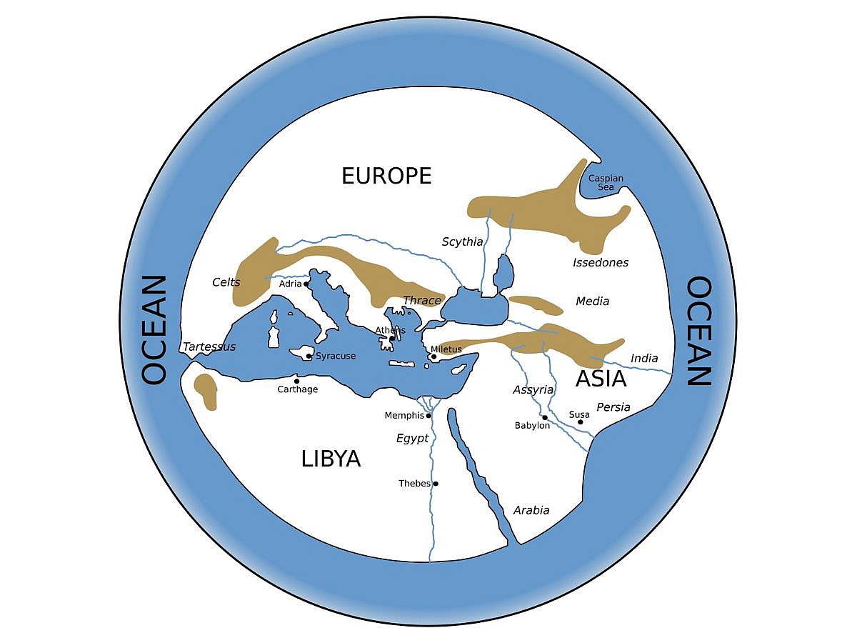
9. Anaximander’s Map
Unlike some of the other entries on the list, there is no surviving example of Anaximander’s map, but there is a close approximation of what it looked like, thanks to the descriptions of the map provided by Herodotus. The map was flat and circular and showed the known lands to the Greeks at the time, surrounded by the ocean.
Read More: Most Infamous Heists in History That Left Experts Baffled
8. The Babylonian Map of the World
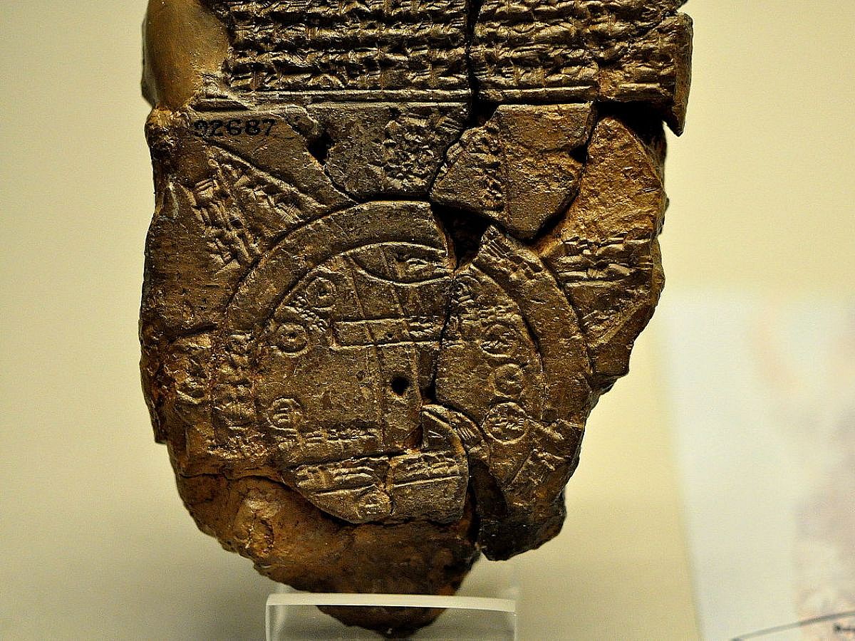
Also known as the Imago Mundi, the Babylonian map is one of the most important old world maps in the world. The map dates back to the 6th century BCE and was created by the Babylonians. The map not only shows off the physical world but the spiritual world at the time. The Kingdom of Babylon is at the center, and Assyria and Elam are nearby. The map also shows the Kingdom surrounded by the ocean.
Check Out: Oddest Jobs People Had From Ancient History
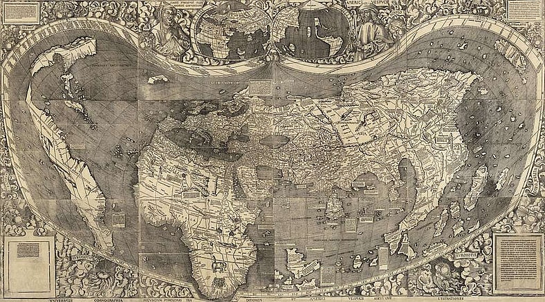
7. The Waldseemüller Map
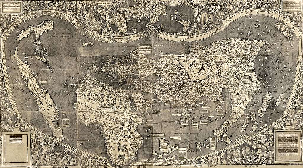
One of the most important old world maps of the early 16th century is the Waldseemüller Map, which was drawn by German cartographer Martin Waldseemüller in 1507. One of the earliest old world maps to identify the newly found continent as “America” is noteworthy. The map offers a thorough depiction of Asia, Africa, and the Americas, taking into account the most recent discoveries made by European explorers.
It is a significant item in the history of mapping because of its impact on later maps and its part in forming geographic nomenclature.
The Waldseemüller Map was a trustworthy depiction of the world at the time since it was based on the most recent expedition data and mapping methods. Its adoption of the name “America” and its accurate depiction of the Americas helped it gain credibility as an authoritative map. The precision of the map and its impact on subsequent cartographic endeavors bolstered its legitimacy and importance.
Related: Most Interesting Stories Behind Time Capsules
6. The Cantino Planisphere
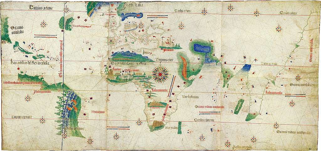
The world map from 1502 known as the Cantino Planisphere, drawn by the Portuguese cartographer Cantino, illustrates the European perception of world geography in the early 16th century. Parts of the Americas, Africa, and Asia are among the recently discovered lands that are depicted in depth on the map. It displays the expanding understanding of navigation and exploration during the Age of Discovery.
The representation of the Americas and the addition of recent discoveries made by European explorers make the Cantino Planisphere noteworthy. Given the rapidly growing body of information about global geography and the influence of exploration on mapmaking, these old world maps mark a significant turning point in the history of cartography. The meticulous depiction of newly discovered lands shows how our understanding of the world was changing at this time.
Based on the most recent exploration data, the Cantino Planisphere offered a precise and comprehensive depiction of the known lands. It gained recognition as a reliable representation of the world, in part because it incorporated new findings and used sophisticated cartography methods. The map’s legitimacy was strengthened by the fact that it was seen as an important tool for exploration and navigation.
Also Read: Islands That Have Disappeared and Why?
5. The Ebstorf Map
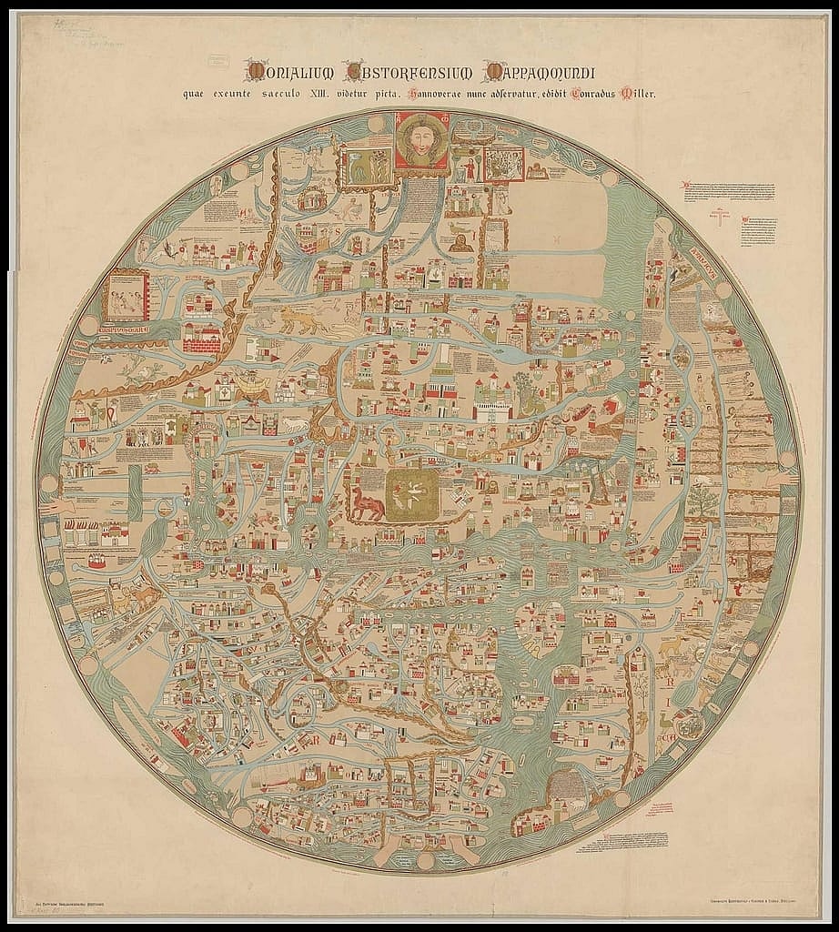
A sizable medieval globe map known as the Ebstorf Map was made sometime in the thirteenth century. The world was divided into three continents by its T-O design: Asia, Europe, and Africa. Jerusalem’s religious significance was reflected in the map’s placement of the city at the center. With its diverse array of mythological animals, biblical scenes, and symbolic depictions, it offered a distinctive viewpoint on medieval topography among old world maps.
The Ebstorf Map is notable because it depicts the worldview of medieval Europe by fusing geographical knowledge with religious symbolism. The map showed how individuals in the Middle Ages understood geography and integrated mythological and moral themes into their perception of the world. The map, which reflected the values and ideas of the period, was used as a religious and instructional tool despite its errors.
Medieval scholars and theologians found the map believable because it combined geographical and theological components. The T-O layout and Jerusalem’s center location complemented modern religious ideas, which helped the map gain legitimacy as a representation of the world. Its apparent authority and accuracy were strengthened by its employment as a moral and pedagogical instrument.
Read Next: Historical Pieces of Civil War Memorabilia
4. The Vinland Map
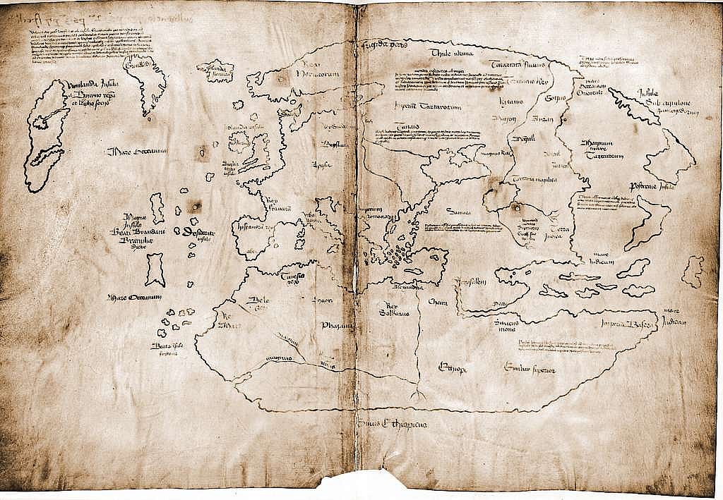
Some people interpret the contentious and mysterious “Vinland Map” as depicting regions of North America that the Norse Vikings are said to have explored. The map, which shows intricate renderings of areas that Europeans were not familiar with at the time, is thought to have been made in the fifteenth century. There has been much discussion regarding the legitimacy of the old world maps; some scholars claim that it is a contemporary fabrication.
Because it may include proof of pre-Columbian European exploration of North America, the Vinland Map is important. Should it be authentic, it would validate Norse explorations of the land long before Columbus. The legitimacy of the map has been the focus of much scholarly discussion and research, although it is still up for contention. An important item in the study of early exploration and cartography is the map.
Some people thought the map was real as it showed Vinland, and there were records of Norse exploration in the past. Its early popularity was aided by the precise terminology used in geography and the thorough depiction of landmasses. Nonetheless, the continuous controversy around its veracity emphasizes how difficult it is to authenticate historical old world maps.
Read More: Former Nations That No Longer Exist
3. The Piri Reis Map
One important item from the early 16th century is the Piri Reis Map, which was made by the Ottoman admiral and cartographer Piri Reis. The eastern coast of South America and portions of the Caribbean are depicted in great detail on the map. It contains a variety of information, including notable locations, coastlines, and even some speculative components. The graphic gained particular notoriety for showing what some experts think could be the ice-free northern shore of Antarctica.
The inclusion of new European discoveries and its meticulous depiction of South America make the Piri Reis Map noteworthy. It is an amalgam of information from several old world maps, such as past charts and reports on navigation.
The map’s representation of Antarctica, however hypothetical, has generated significant interest and controversy among historians and scientists. Its precision in representing key coastline characteristics was advanced for its period.
Check Out: What Are the Seven Wonders of the Ancient World?
2. The Mappa Mundi
A collection of old world maps from medieval Europe known as the Mappa Mundi presented the world in a symbolic and religious light. Among the most well-known is the Hereford Mappa Mundi, which dates back to approximately 1300. Jerusalem was always in the center of these old world maps, signifying that it was the moral and theological hub of the globe. Alongside geographical elements, they frequently incorporated biblical events, mythical animals, and allegorical depictions.
The medieval European worldview, which blended geographical knowledge with elements of religion and mythology, is reflected in the Mappa Mundi. The maps functioned as tools for moral and religious instruction in addition to being geographic guides. They exemplified the medieval notion of a universe under divine law, in which spiritual teachings were entwined with geographical knowledge. The maps were useful for learning how medieval people perceived the world and their place in it, despite their errors.
Because the Mappa Mundi aligned with modern religious and philosophical ideas, it was acknowledged as a legitimate depiction of the world. The fusion of geographical and mythological components represented the medieval synthesis of knowledge, in which old world maps were regarded as instruments for both devotion and teaching. The conformance of the maps to intellectual and theological views of the period gave them authority.
Also Read: Rare Artifacts from the Ancient Egyptian Era
1. The Tabula Rogeriana
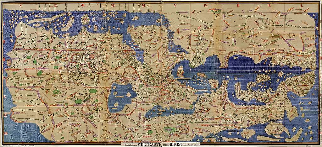
The Arab geographer Muhammad al-Idrisi produced the ambitious and intricate Tabula Rogeriana, a global map made for King Roger II of Sicily. This map, which was created in 1154, was remarkable for its degree of precision and detail at the time. It was first printed in the form of a book after being etched on a sizable silver tablet. The map, which focused on the Mediterranean region and portions of Europe, Africa, and Asia, showed the known world in an oblong form. Al-Idrisi’s research drew from a variety of sources, such as historical old world maps, scientific theories, and travelogs.
Because it constituted one of the most sophisticated cartographic endeavors of the Middle Ages, the Tabula Rogeriana is noteworthy. It showed a great level of comprehension of the Mediterranean and its environs, combining sophisticated cartography methods with empirical information. The map showed important cities, trade routes, and intricate shoreline outlines, all of which were a reflection of the Islamic world’s considerable exploration and travels during that time. The map proved to be an invaluable resource for trade and navigation even with its errors, including its speculative representations of legendary regions.
Al-Idrisi’s map was well-respected because of its solid empirical foundation and reliable sources. The map was a reliable depiction of the known world because it brought together academic research and practical understanding. The accurate and thorough depiction of well-known areas contributed to its appeal by confirming its credibility in the eyes of modern researchers and explorers.
You May Also Like

Kim Kardashian Revisits the Auction Battle for Her Dad’s $80K Bible